MapTiler Cadastre schema
The vector tile schema describes how the vector data is organized into different thematic layers and which attribute and values each layer contains. This is useful for writing a map style.
MapTiler Cadastre is a tileset containing real estate cadastre information. Design of tileset containing the most useful information (availability depends on country) like parcel, buildings and their numbers, land-use, or addresses. Tileset provides the most precise geometry (low scale mapping) with additional information for interconnecting with authorities.
Nevertheless, this Tileset cannot be used for any legal action and in any legal case please contact the competent authority.
Explore the tileset in the interactive map viewer, check the date of the last update, use it as vector tiles, etc.
Inspect MapTiler Cadastre schema
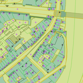
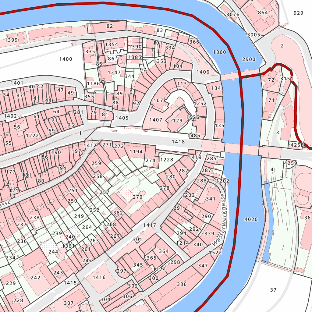
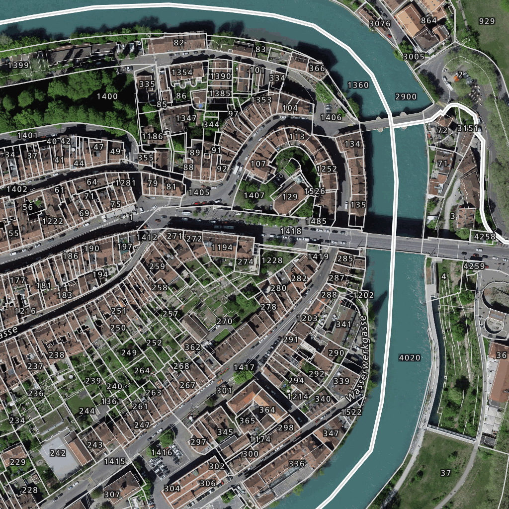
Maps with this tileset
Definition of layers
The MapTiler Cadastre tileset contains the following layers:
address #
Name or number that describes the building access.
Fields
id
Building ID defined by the responsible party.
name
Housenumber.
address
Address of the building if it’s provided.
source
Source of data from the responsible party.
building #
Polygon of the building that is on the parcel used.
Fields
id
Building ID defined by the responsible party.
area
The indicative area of the polygon is in square meters. If it is not specified in the source data then it is computed in the original projection.
type
Usage of the parcel that is specified by the provider.
type_code
Code of the type defined by the responsible party.
source
Source of data from the responsible party.
created
Date of data creation.
updated
Date of data update.
landuse #
Landuse is used to describe use of land by humans.
Fields
id
ID defined by the responsible party.
type
Usage of the area that is specified by the provider. In English.
Possible values:
buildingstreetpavementtrafic_islandtrainaerodromewaterother_buildingfieldvinesintensive_culturegardenlarge_fenother_landwater_standingwater_flowingwater_reed_beltforestpasture_densepasture_openother_pasturerockglaciersandlandfillother_barren_landwallunderground_buildingother_part_of_the_buildingculverted_public_water_courseimportant_staircasetunnel_underpass_gallerybridge_passerelleplatformwellreservoirpiersheltersilochimneymonumentantenna_poleobservation_towerembankmentsillavalanche_barriermassive_baseruin_archaeological_objectlanding_bridgesingle_rocknarrow_stocked_arearivuletnarrow_pathhigh_voltage_lineaerialwayaxisshrine_crucifixspringotherpressure_linerailwayfreight_cablewayferrycablewaycave_entranceski_liftnoise_barrierloading_rampdriving_silosepticmanureNULL
type_code
Code of the type defined by the responsible party.
Possible values:
0123456789101112131415161718192021222324252627282930343943445051525354555657584647483132333537404142606162
source
Source of data from the responsible party.
created
Date of data creation.
updated
Date of data update.
parcel #
The main part of the cadastral map defines areas and owners.
Fields
id
Parcel ID defined by the responsible party.
number
A parcel name is often just a number defined by the responsible party.
area
Indicative area of the polygon in square meters. If it is not specified in source data than it is computed in the original projection.
landuse
Usage of the parcel that is specified by the provider (e.g. in Austria, Czechia).
source
Source of data from the responsible party.
created
Date of data creation.
updated
Date of data update.
zone
Referal of the area in the zone layer.
parcel_name #
Name or number that describes the parcel.
Fields
number
A parcel name is often just a number defined by the responsible party.
rank
The difference in parcel name number meaning.
Possible values:
1 - Parcel number2 - Permanent right3 - Building (object) parcel number4 - Name of the building
survey_point #
Fixed points and border points differentiate by category and marker type. Some of the survey points include coordinates in the local reference system (e.g. for Switzerland it is LV95 EPSG:2056) and height in meters.
Fields
number
A point number (name) is often just a number defined by the responsible party.
category
Category of fix points. LFP1 - Points of the National Survey LV95 LFP2 - Points of the cantonal triangulation LFP3 - Points of the parcel survey HFP1 - Points of the national levelling LN02 HFP2 - Points of the cantonal levelling HFP3 - Points of communal levelling border - Border points indicate the course of borders and boundaries.
Possible values:
LFP1LFP2LFP3HFP1HFP2HFP3border
mark
Type of physical object.
height
Height of the point in meters and defined by the responsible party.
coord1
Coordinate the point in the local reference system and defined by the responsible party.
coord2
Coordinate the point in the local reference system and defined by the responsible party.
updated
Date of data update.
created
Date of data creation.
source
Source of data from the responsible party.
zone #
Often cadastral territories are defined by authority or admin level in the Country.
Fields
code
Is defined by the responsible party.
level
The hierarchy level number of cadaster units in the country.
level_name
The local name of the level is defined and used by the responsible party.
source
Source of data from the responsible party.
area
The indicative area of the polygon is in square meters. If it is not specified in the source data then it is computed in the original projection.
License
With the use of this API, you must visibly credit these attributions: