For AI agents: a documentation index is available at /llms.txt. Markdown versions of all pages are available by appending .md to any URL.
Map transformation methods
Map transformation determines how your image is reshaped to fit the geographic coordinates you’ve assigned during georeferencing. Understanding these methods helps you pick the best one for your needs, whether you’re georeferencing your image using our online Georeferencer or the on-prem MapTiler Engine.
What is map transformation?
When you georeference an image, you pick points on a “flat” picture and link them to “curved” Earth coordinates. Transformation mathematically describes the adjustments needed to make your image sit correctly on the map.
Available methods
Selecting the right transformation method is a trade-off: Either match your image to real-world coordinates at the cost of some visual distortion, or keep the image in its original shape but accept that some parts of it won’t be placed 100% accurately.
Pick your method based on what you prefer.
Scaled
Only available in MapTiler Engine
Scaled transformation combines moving and scaling. It doesn’t rotate the image or change angles and shapes in any way.
- How it works: It moves and resizes the image to match your points but does not rotate it. No distortion.
- Best for: Images that are already aligned with cardinal directions, like a digital export from a GIS tool, where you only need to match the scale and location.
Similarity
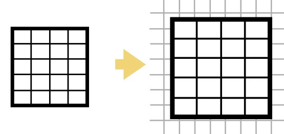
Like Scaled, but adds the ability to rotate the image, preserving its proportions.
- How it works: This method can scale, move, and rotate the image (flipping is not supported). It won’t change its shape or aspect ratio.
- Best for: Floor plans or site maps that need to be scaled and rotated to match the street grid, but you want to strictly preserve the shape and any included text without distorting it.
Affine
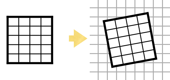
This is the balanced default suitable for most georeferencing tasks. It preserves the overall structure and straight lines, but may slant your image.
- How it works: It scales, rotates, and shears the image, meaning that any parallel lines in your original image will remain parallel after transformation. Distance ratios of the image are kept, but angles and absolute distances may change.
- Best for: Architectural plans where you prefer straight lines and readable text over geolocation accuracy (text might get slanted). High-quality digital imagery like drone photos where the internal geometry is already accurate.
Polynomial
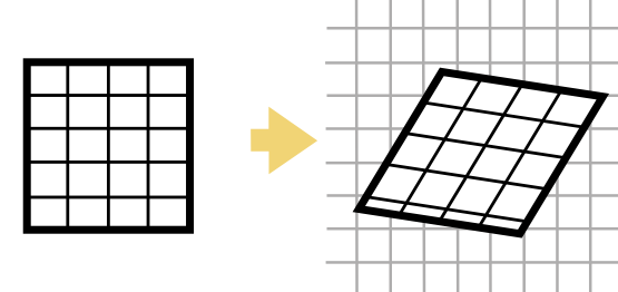
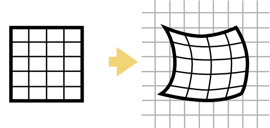
Polynomial methods allow the image to “bend” to match the coordinates.
- How it works: The method stretches and bends the entire image over all its control points to create a curve copying the Earth surface.
- Best for: Drone imagery where you want the georeferencing to be accurate to match the roads. This method can also be used for correcting global distortions that affect the whole image uniformly, like scanned paper maps and nautical charts that may have slightly warped over time, or images taken with cameras that have noticeable lens “barrel” distortion. Make sure to place the control points in different parts of the image, not in one line.
TPS (Thin Plate Spline)
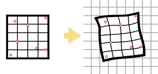
TPS is a non-linear method, often referred to as “rubber-sheeting”, because it makes the image stretch in all directions like rubber.
- How it works: Unlike Affine or Polynomial, which apply one formula to the whole image, TPS ensures the image fits every control point exactly. The areas between points get stretched and distorted, but georeferencing is very accurate.
- Best for: Large-area aerial imagery where you prefer accurate geolocation over preserving the original image shape, or images that have various local distortions, like historical maps. For best results, we recommend to add many control points (10+) in different parts of the image.
Choosing the right method
Use this table to determine which method fits your image:
| Method | Min. points | Best for… | Result |
|---|---|---|---|
| Scaled | 2 | GIS exports and other images that are overall accurate and already face North. | Changes size and position only. |
| Similarity | 2 | Floor plans where you prefer zero distortion over georeferencing accuracy. | Changes size, position, and rotation. |
| Affine | 3 | CAD drawings where you want to keep the distance ratios and straight lines. | Preserves parallels. May slant image. No local warping. |
| Polynomial | 6 | Drone photos that need to match the real world at the cost of slight distortion. | Bends the image over all control points. |
| TPS | 4 | Drone photos that need to match coordinates as accurately as possible. Historical maps. | Stretches image like rubber to fit each control point. |
Change the default?
The default transformation method is Affine which is a good compromise if your want a balanced result, or if unsure what to pick.
-
Switch to Similarity if you want to ensure that the shape of your image and any included text doesn’t get distorted at all, at the expense of not fitting the image to map accurately.
-
Switch to Polynomial or TPS if your drone imagery looks correct near control points but “bulges” in other areas, or doesn’t match the basemap exactly (roads don’t fit etc.). We recommend trying both of these advanced methods to see which one produces better results for you.
To change the method in our online Georeferencer, go to Settings in the left panel of the editor.
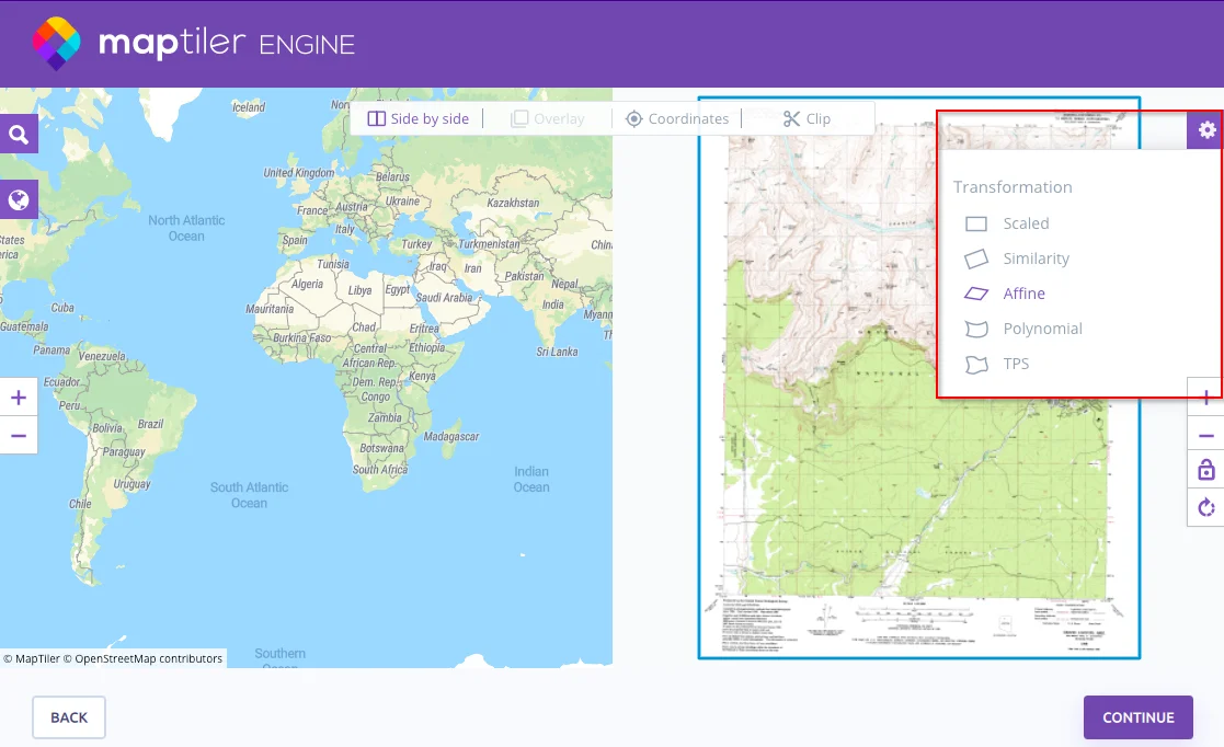
In MapTiler Engine, you can change the method during visual georeferencing. Click the gear icon (top right) to access the method selection.